Report Map Viewer
This view allows you to navigate a geospatial web map of your solar report
Viewing Anomalies
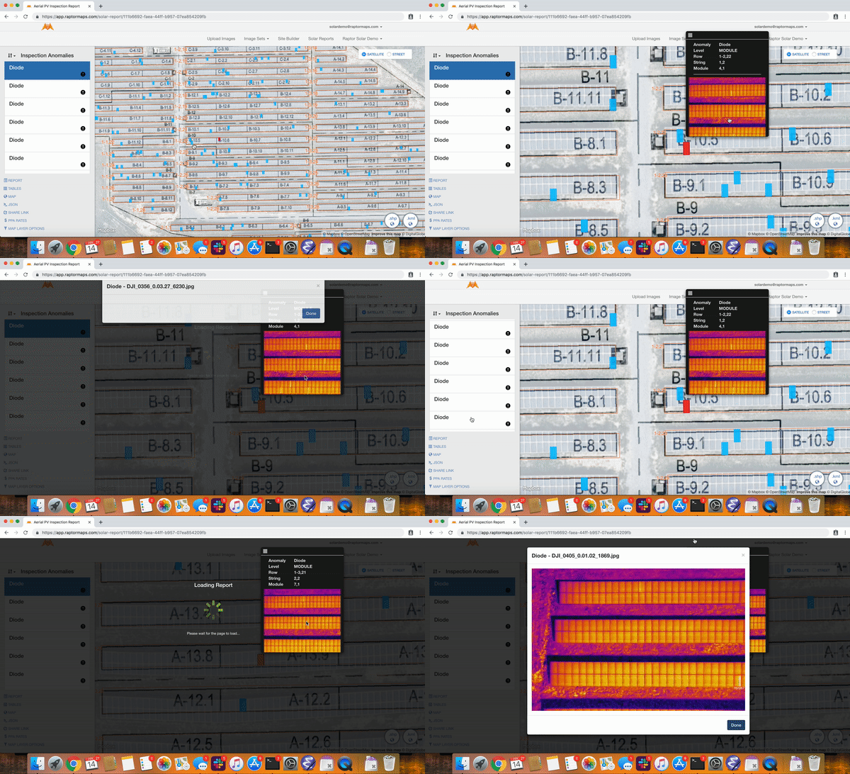
You can view the original imagery that is linked to each anomaly in the map viewer by two ways:
- Clicking the anomaly on the scroll bar on the left
- Holding the "m" key while clicking on the anomaly in the map.
Once you select the anomaly a black popup window will appear. If multiple images are associated to this anomaly you can scroll inside of the popup. Once you select the specific anomaly inside the popup you can click the image to see an enlarged view of the image and the bounding box that surrounds the anomaly.
The video below shows this functionality.

Updated 3 months ago
